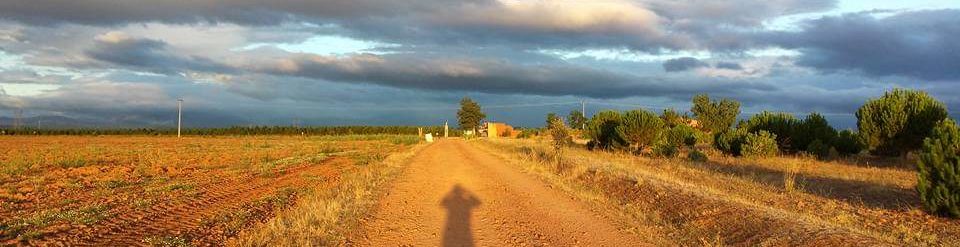
The Maamturks Ultra Challenge is an idea that originated during the 2020 COVID-19 lockdown, as a way to extend the traditional Maamturks Challenge into a loop circuit that avoids carpooling.
Although originally conceived as a logistical convenience, the route showcases the best trails in Connemara and creates probably the toughest hiking challenge in the country.
It is about 55 km with 3000 metres of ascent that follows the scenic Western Way before tackling the traditional Maamturks route which itself already has reputation of being one of the toughest hiking challenges in the country. This extended version adds an extra 30 km of waymarked trail to the traditional challenge. The extra hardship is compensated for by vistas of a beautiful scenic trail along the Western Way.
The Maamturks Ultra Challenge starts and finishes at Leenane Hotel in the village of Leenaun. The route follows the Western Way for 30 km to the start of the traditional Maamturks Challenge and then follows the route of the Maamturks Challenge back to Leeanne Hotel.
A route of the challenge can be viewed from the following Viewranger website. A GPX of the route can also be exported and imported into the GPS device of your choice.
The pharmacist told me that I have a subconjunctival hemorrhage and insists on taking my blood pressure. Two days earlier, I had completed Ireland’s toughest hiking challenge, the lug challenge.
The Lug challenge is a self-navigated biennial event that spans 18 mountain tops, covers 53 km and climbs over 2300 metres. The event takes place across open mountain terrain which includes marsh and bog. A tough event made much tougher from a night of relentless rain that made the underfoot conditions the worst in at least fourteen years.
But the story begins three days before this event, on Wednesday, when I prepare my strategy to aim for a podium finish. I have chased after a top-place finish in the Lug for four years. In the last one, I finished seventh. But this year, I felt a a podium finish was achievable, to finish in the top three, a symbolic outcome, an overcoming, and it was either now or never. This time I had the appetite and the mental fortitude to push my mind and body to its limits.
I started my preparation scientifically, by switching to a very high carbohydrate diet.
This is called carbo-loading where you load your muscles and liver with a fuel called glycogen. So for three days, I ate pasta and Spaghetti for breakfast, lunch and dinner. By Friday night I had gained two kilograms in body weight. This weight isn’t all fuel, as each gram of glycogen binds to about 3 grams of water. Although this extra weight gain could be viewed as an unnecessary burden, it provided an efficient source of energy and the weight penalty could be mitigated by carrying less food and water.
On Saturday morning, a Three O’Clock alarm has me awake and on a bus by Four AM, along with another hundred participants.
Waiting for the bus that will drop us at the start
The bus drops us off on the side of a desolate road in the Dublin Mountains, in rain and heavy mist. At 5:15 AM, I commence my third lug challenge.
I have already completed two lug challenges and after each one, have said I would never do it again. But here I am, again.
It is two hours to the next control station and already my feet are soaked through. This time I am wearing non-waterproof trail shoes. The problem with waterproof shoes is that when water gets in, and it will get in, it stays in. Half an hour into the challenge, both of my feet are soaking wet.
My strategy for a good time is to reduce the weight that I carry including the clothes that I wear. But for such a strategy to work requires a sufficient exothermic reaction to produce enough heat to avoid hypothermia. In other words, I must maintain a fast pace to avoid getting too cold. Especially with wet feet accelerating the heat loss.
Some people have already made their own way to the start line and have a fifteen minute head start on me.
I start out easy, passing participants along the way, making my way through two hours of bog, white-out and rain, until I make it to the first control station at the Sally Gap. I catch up with the group of five that had started earlier. After inquiring at the control station, I learn that there are two fast runners in front of this group which puts me in eight position. Motivated now, I feel confident that I can improve on this position, so I push on though taking myself into third position. I’m concerned that I may be pushing my pace too early and burn out like I did in the 2017 challenge or make a hasty navigational decision that will cause me to lose ground.
As I traverse from the Sally Gap towards Gravala, I lose the faint track taking me onto uneven ground which severely hampers my pace. I am now moving very slowly but burning a lot of energy and fatiguing for no benefit.
Unlike a road event, such as a Marathon, where the surface is constant irrespective of weather conditions, an off-road event is determined mainly by the terrain and underfoot conditions. The difference in effort between wet boggy conditions and a dry bog can be as much as double the energy requirement and hence double the potential time to completion. Achievement in such events is normally considered in terms of finishing positions rather than comparing absolute times to previous events.
I stop to check my map and realised that I have veered too far right into very uneven and steep ground, which slows me down considerably.
I try to maintain my pace but now my heart is going into its anaerobic zone, the place where you run into oxygen debt. This would be unsustainable and quickly result in burn out. But my dilemma is that if I slow down too much and lose my position after having fought so hard for it then I will mentally throw in the towel.
Events like this are at least 80% mental and 20% physical. Any mental doubt now will feed on itself and only increase over the next eight hours. But I know that over the next hill, the gradient flattens and there is some downhill.
I gamble by pushing my body into oxygen debt to get out of this slough of despondency, with the hope that I can recover on the next downward section.
The gamble pays off. I’ve only lost about fifteen minutes, and I can now bring my heart rate back out of the red zone to a sustainable level. I think I’m still ahead. I can hear voices in the distance but can’t tell whether there are in front of me or behind. I haven’t drank any water for three hours now but I don’t want to stop and so I push on again. I reckon there must have been about a litre and a half of water in my body from carbo-loading. When I arrive at the third control station, I learn that I’m still in third position.
Encouraged, I push on quickly, but, as it turns out, a little too hastily. I quickly pick up the correct track from Mullaghcleevaun, but in my haste, I veer too far right and then over-correct by veering too far left. After stopping multiple times to check my map, I realise this navigational error has cost me another fifteen minutes.
I now hear voices parallel to me and see the group I had overtaken two hours earlier ahead of me. I’m about to enter the pain cave.
The pain Cave is the mental fatigue you feel when your already tired and realise the distance still in front of you.
I have needlessly lost half an hour in navigational errors due to too much haste. My heart sinks, I have gone from third position to eight position. I start following the group but it takes me some time to catch them. My heart rate has now gone into the anaerobic zone again, which is not sustainable.
This is my low point. I abandon the idea of finishing in third place. Another dream gone as my hopes have flown before. I am now deep in the pain Cave.
As I catch the group, I tag along at their pace and my heart rate begins to settle back down into the upper limits of my aerobic range – a range that I could sustain for the distance. Buoyed by the comfort that I can at least keep their pace and still finish in the top ten, I start assessing the group. I can see that the three people towards the end of the group are outside their comfort limits and won’t maintain this pace for the full course. I overtake them which puts me in fifth position of a very close group. I’m still not sure if my assessment is correct so I decided to test it by pushing the pace for a while. I proceed to the front of the group, where I regain third position, and then start pushing the pace.
To get someone to chase you, you need to increase the pace very subtly, almost imperceptibly. Then continue gradually increasing it very, very slowly.
My tactic works, the two leaders give chase, the last three people in the group now realise they can’t keep up and slow down considerably splitting the group. I can’t maintain this pace so I gradually drop back from third position to fifth position where I just draft behind the two leaders and get my heart rate back down to a sustainable level. From the top of Toneaglee, I realise this is my last opportunity to consolidate my position.
I need to act now and make it clear that I’m taking a decisive lead. So I push ahead again, into third place and start opening a gap, leaving no misunderstanding that I’m determined to take third position.
Events like the Lug Challenge are not just about speed, but also navigation, tactics and an overall strategy.
With equally matched participants, it can be like a chess game
I keep the pace and hit the next control station, the Wicklow Gap, in third position. This is the second control station for me to hit in third position.
I made another navigational error after Lough Ferrib, but I’m confident that I have a good chance of holding onto third position.
Even though my feet are soaked, I’m traipsing through water and bog, I feel very little pain and I’m feeling great. Actually feeling on a real high.
Runners would call this the Runner’s High.
The Runner’s High used to be credited to a brain chemical called Endorphins, the body’s natural pain killers, similar to morphine. But more recent research from the University of Heidelberg suggests that another chemical, endocannabinoids, having a similar effect to cannabis, is the main contributor to this high. The research is showing that continuous rhythmically exercise for at least two hours at moderate intensity, such as the lug challenge, produces this state.
I’m feeling good now and totally in the flow.
The last major climb is to Lugnaquilla and I now push on at a steady pace. At Lugnaquilla, I’m still in third position, but there is still another 6 km to the finish line, so I keep the pressure on. My leg muscles are pulling all the oxygen out of my blood system, leaving me lightheaded. I imagine that there are others behind me, hot on my trail. I can feel my heart pumping like it’s expanding to fill my ribcage, the blood pounding through the back of my head. As I descend from Lugnaquilla, the vision in my left eye starts to blur.
Eventually I reach the finish line.
I have now reached the finish line in 10 hours and 30 minutes, an excellent time considering the underfoot conditions, placing me clearly in third position.
This is a podium finish, finishing in the top three. The event has left me elated.
My mind has triumphed over the body and I feel a great sense of elation, like I’ve conquered something, something deep within my being.
Two days later, being concerned about by bloodshot left eye, a subconjunctival hemorrhage, I visit the local pharmacist. He takes my blood pressure which is normal and concludes that the most likely cause for this type of condition was the elevated heart rate for an extended period of time.
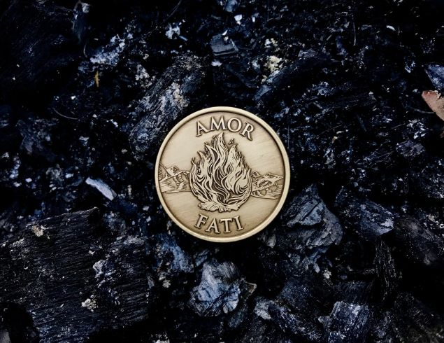
The event has taught me several lessons and has reaffirmed my Stoic philosophy. Not the least of which is finding strength and support from deep within one’s innate self. Working hard at what’s within your control, refusing to worry about what’s outside your control and the wisdom to know the difference.
A Munro is defined as a mountain peak over 914 metres (3,000 feet). Ireland has 13 such mountain peeks.
These peaks get their name from Hugh Munro, who in 1891 published a list of all the Scottish peaks above this height.
Strictly speaking a Munro outside Scotland is called a Furth. Other names include three-thousanders. Whatever name is used, they all refer to the same thing, a mountain peak with an elevation of at least 3,000 feet (914 metres). An Irish Munro also requires a topographcal prominence of at least 15 metres.
In Ireland there are 13 such Munros, ranging from the highest, Carrauntoohil, at 1039 metres to our lowest Munro, Galtymore, at 919 metres.
The full list of Irish Munros are shown below.
No.
Name
Range
IG Ref
Height (Metres)
Prominence (Metres)
1
Carrauntoohil
MacGillycuddy's Reeks
V803844
1039
1039
2
Beenkeragh
MacGillycuddy's Reeks
V801853
1010
91
3
Caher (East Top)
MacGillycuddy's Reeks
V792839
1001
100
4
Cnoc na Péiste
MacGillycuddy's Reeks
V836842
988
254
5
Caher (West Top)
MacGillycuddy's Reeks
V789840
975
24
6
Maolán Bui
MacGillycuddy's Reeks
V832838
973
41
7
The Bones / Carrauntoohil Tooth
MacGillycuddy's Reeks
V800847
959
37
8
Cnoc an Chuillin
MacGillycuddy's Reeks
V823833
958
54
9
Brandon Mtn
Brandon Group
Q460115
952
927
10
The Big Gun
MacGillycuddy's Reeks
V840845
939
70
11
Cruach Mhór
MacGillycuddy's Reeks
V841848
932
32
12
Lugnaquillia
Dublin.Wicklow
T032917
925
849
13
Galtymore
Galty Mountains
R878237
919
899
Note: Some sources include Cnoc an Chuillin East Top, at 926 metres, IG V828834, as a Munro, giving a total of 14 Irish Munros.
However, it's prominence is not sufficient to be listed by The Scottish Mountaineering Club.
Logistics of climbing all the Irish Munros in a Weekend
The following itinerary, courtesy of Dublin Free Hiking, is an efficient way to complete the Irish Munros, by starting in the east of the country at Lugnaquilla and finishing on the west coast at Mount Brandon. Climbing all the Irish Munros will require about 370 km of driving between the various trailheads.
Day 1
Starting from Fenton’s Pub (Irish Grid Reference: S 973 935 or GPS: N52.984,W6.552), the most easterly Irish Munro can be bag, followed by 170 km drive to the Galtymore trailhead (IGR: R 893 203 or GPS: N52.335,W8.1575), near the village of Skeheenaranky, to climb the Galtymore peak.
No.
Name
Range
IG Ref
Height (Metres)
Prominence (Metres)
1
Lugnaquillia
Dublin.Wicklow
T032917
925
849
2
Galtymore
Galty Mountains
R878237
919
899
Day 2
The next trailhead is at Cronin’s yard, which is a 130 km drive from the Galtymore trailhead. Starting from Cronin’s Yard Car Park (IGR: Q 476 118 or GPS: N52.02584,W9.69658). From here ten of the Irish Munros can be bagged by following the Hags Glen Circuit with one diversion to include Caher East and West Top.
No.
Name
Range
IG Ref
Height (Metres)
Prominence (Metres)
1
Cruach Mhór
MacGillycuddy's Reeks
V841848
932
32
2
The Big Gun
MacGillycuddy's Reeks
V840845
939
70
3
Cnoc na Péiste
MacGillycuddy's Reeks
V836842
988
254
4
Maolán Bui
MacGillycuddy's Reeks
V832838
973
41
5
Cnoc an Chuillin
MacGillycuddy's Reeks
V823833
958
54
6
Caher (East Top)
MacGillycuddy's Reeks
V792839
1001
100
7
Caher (West Top)
MacGillycuddy's Reeks
V789840
975
24
8
Carrauntoohil
MacGillycuddy's Reeks
V803844
1039
1039
9
The Bones / Carrauntoohil Tooth
MacGillycuddy's Reeks
V800847
959
37
10
Beenkeragh
MacGillycuddy's Reeks
V801853
1010
91
Day 3
Finally, a 70 km drive gets you to the last trailhead, Faha Carpark (IGR: Q 493 1201 or GPS: N52.2395,W10.206).
No.
Name
Range
IG Ref
Height (Metres)
Prominence (Metres)
1
Brandon Mtn
Brandon Group
Q460115
952
927
When climbing the Irish Munros as part of a timed event, the clock starts at the first trailhead and stops at the trailhead after the final peak.
For example, if you were following the above itinerary, timing would start at the Fenton’s pub trailhead, before climbing Lugnaquilla, and finish at the Faha Carpark, after descending mount Brandon.
In Conclusion
Whether you want to call it the Irish Munros, the Irish Furths or the Three-Thousand Series, if you climb the peaks listed above you will have completed the highest Irish peaks above 914 metres with a prominence of at least 15 metres.
The Lug Walk is a long distance linear traverse of the Dublin and Wicklow mountains, taking in more than 18 summits, while covering 51 km with 2400 meters of ascent. It is the toughest challenge in the Irish Hiking Calendar.
.
The walk, over open mountain terrain, starts at Stone Cross, near Bohernabreena in the Dublin mountains, and finishes, between 10 and 16 hours later, at Seskin in the Glen of Imaal.
The toughest challenge in the Irish Hiking Calendar
Walk Johnny Walk
This is undoubtedly the toughest challenge in the Irish Hiking Calendar. It’s not just the early 5:00 AM start, or the 51 km distance that you walk on the day. It’s not the fact that you climb 2400 metres taking in the highest highest eighteen peaks in the Dublin and Wicklow mountains. It’s all of these, but then add in bog, and then more bog. Instead of getting the normal foot bounce from solid ground which each footfall, you’ll be engaging extra muscles to pull that foot back out. If it’s a typical lug start, then you can expect to be blessed with the famous kippure micro-climate of horizontal rain. Don’t expect to have any dry garb by the time you arrive at the Wicklow Gap. So why do it? That’s a good question.
The walk is organised every two years by the Irish Ramblers Club. Two years seems to be the amount of time necessary to forget how hard it is. I have done this challenge twice and each time I’ve said never again, but here I am preparing for it a third time.
The walk itself dates back to 1964 when it was first organised by the Irish Mountaineering Club and was known as the Arnott-Russell Mountain Endurance Test.
Now, if by any chance 51 km is not enough of a challenge for you, then you could always consider the tougher 85 km Lug Endurance Challenge.
The Blackstairs Challenge consists of a distance of 31 km with 1700 metres of ascent along the Carlow-Wexford border.
It’s one of those walking events where you can choose how much of a challenge you want it to be by simply varying your speed. A slower pace makes for a very enjoyable leisurely walk. Pushing the pace on this walk turns it into a very hard challenge to rival any serious competitive event.
Is this a walk and or is it a competitive challenge? It’s hard to say, but allow me to indulge in some subjective reasoning here. I would say that completing this event in a time under six and half hours makes this a seriously hard challenge, whereas in a time over seven hours, I would classify it as challenging walk.
Johnny’s subjective classification:
Serious Challenge: < 6.5 hours
Respectable Walk: > 7 hours
Leisure day out: > 9 hours
Note that this classification is only my own humble opinion.
The walk itself doesn’t have the climbing toughness of the Maamturks Challenge or the bog drudgery of the Lug Walk, but nevertheless it’s a beautiful walk and one that can be taken at a leisurely pace or turned into a very serious challenge by doing it at speed. The walk is organised by the Wayfarers Association who do an excellent job every year in organising what is probably the most enjoyable challenge hike in the province of Leinster.
The walk takes an average time of nine hours to complete. Though the last time that I did this hike, two years ago, I clocked in at four hours and fifty four minutes, a record for my club, bringing me in as the fastest hiker or fourth place overall after three runners.
But it’s not all about speed or who’s first, it’s a beautiful walk for its own sake. Apart from being a challenge event, this is a wonderful solitary walk that can be done at anytime when you need time alone for contemplation. Contemplative walking is a whole different ball game where focus switches from objective measurements, like distances and finish times, to subjective qualities and experiences. Which is better? In my view both have a place, like two sides of the one coin, the yin and yang if you like. It’s like the weather, you can’t appreciate the sunny calm days without experiencing the wet and stormy ones.
For 2019, the ending of the challenge has changed. I have had the great pleasure of reccing the new route with the Wayfarers Association and have included the GPS route below.
To give you an idea of the terrain, I have included my route from 2017. Please note that this includes the 2017 ending, which differs from the 2019 ending.
The Maamturks Challenge is an annual linear hiking event organised by NUI Galway Mountaineering Club. The route is a tough 25 km hike with 2300 metres of ascent that traverses the Maamturks Mountain range in Connemara.
The official event is held in the Spring of every year, with those participants who successfully complete the course, by reaching specified control points within the given cut-off times, receiving a certificate of completion. It should be noted that not everyone who attempts the challenge will actually complete it. The traverse is also attempted outside the official event by groups organising their own logistics, but still attempting to hit the same control points.
The distance and ascent may seem less daunting until you consider the terrain and elevation. It’s not a gradual climb on a waymarked trail, but rather it’s a very hard slog over rough open mountain. It consists of a series of steep energy-sapping climbs followed by steep descents. Then there is the difficulty of the navigation in very unpredictable weather.
According to Mountain Views, a respected Irish mountaineering website, it is the second toughest challenge in the country1. An article in the Irish Times newspaper reported it was harder than climbing Kilimanjaro2. In hillwalking circles it is spoken about with great respect.
The unrelenting steep climbs and descents are what characterises this hike and garners so much respect for it. Even the names of the locations can conjure up ominous visions of what awaits. One such name is “the col of despondency” which might have been taken out of some puritanical book such as “Pilgrim’s Progress” as a gauge of how you feel at this point. At this point the fatigue from the day’s unending ups and downs and the rather uninviting view to the next seemingly insurmountable climb towards Leenane Hill will lead a strong feeling of despondency. Here you will see people panting, falling, and crawling – in fact anything to get themselves up that last pull. Should you consider quitting at this point, well the available options are pretty unattractive also.
The following points (with Irish Grid Coordinates) must be hit in the following order.to complete the challenge:
Eventually, having made it to the finish, you will cast your weary eyes on the quaint village of Leenane, where you can relax in the satisfaction of having completed the second toughest hiking event in the country.
Experienced hikers tend to take between ten and twelve hours to complete the traverse. The walk is already challenging enough in itself, but when you add speed to the equation you bring a new dimension of suffering. Most participants are happy to complete the challenge within the standard cut-off time, but there is a small cohort not content on just finishing, but want to push the limits of human endurance and stamina by adding the extra burden of a time constraint.
The challenge starts at a non-descript pull-in on the side of the R336 road about four kilometres from Maam Cross, at the Irish Grid Reference: L 964 497 or GPS coordinates N53.488 W9.559.
A route of the challenge can be viewed from the following View Ranger site. A GPX of the route can also be exported and imported into the GPS device of your choice.
A GPX of the route can be viewed and download from View Ranger.
Privacy & Cookies: This site uses cookies. By continuing to use this website, you agree to their use.
To find out more, including how to control cookies, see here:
Cookie Policy